Kentucky Lake Boating Guide: Marinas, LBL & Bass Fishing
Kentucky Lake boating guide: 160,300 acres, 2,064 shoreline miles, LBL bays, marinas, bass ledges and the two-state license line.
9 min readKentucky Lake
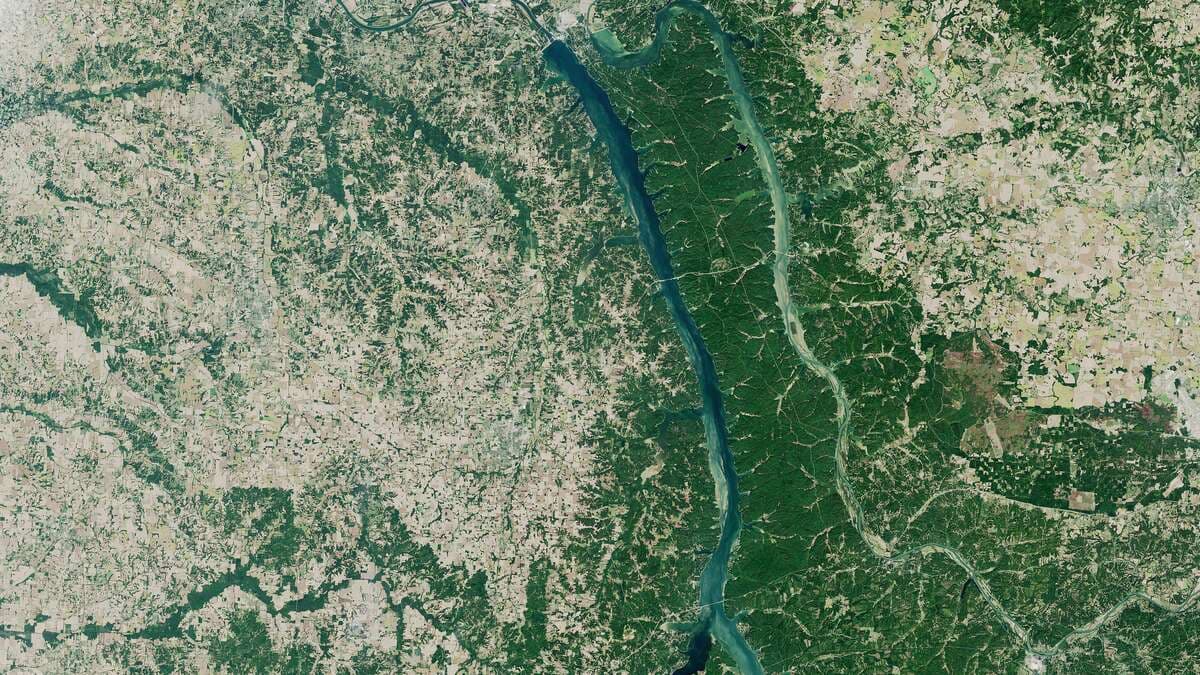
A Kentucky Lake boating guide starts with a number no other lake in the East can match: 160,300 acres of surface at summer pool, spread along 184 miles of the Tennessee River between Kentucky Dam and Pickwick Landing Dam. It is the largest artificial lake by surface area east of the Mississippi, and it behaves like several lakes at once — a barge channel with tow traffic, a tournament bass fishery and 300 miles of undeveloped federal shoreline. Our roundup of the best lakes for boating ranks it on size alone; this guide is about running it well.
Kentucky Lake Boating Guide: 184 Miles of Tennessee River
Kentucky Lake backs up behind Kentucky Dam near Gilbertsville — at 206 feet high and 8,422 feet long, the longest dam in the TVA system and the lowest of the nine TVA dams on the Tennessee River. Built from 1938, it closed its gates on August 30, 1944, generated that September, and finished filling in 1945 — opening the river to year-round navigation. From the dam — itself 22 miles above the Tennessee's confluence with the Ohio — TVA's Kentucky Reservoir page counts 184 miles south to Pickwick Landing Dam near the Tennessee–Alabama line.
The shoreline math is the lake's signature: 2,064 miles of shore wrapped around those 160,300 acres, split between two states (TWRA counts 52,083 acres in Kentucky, 108,217 in Tennessee). Three miles above the dam, a lock-free canal cuts east to Lake Barkley on the Cumberland River; Barkley was built to the same pool elevation, so the two form one connected cruising ground with Land Between the Lakes in the middle. Commercial tows work the marked 9-foot navigation channel the whole length — a working river that hosts one of the East's largest recreational fleets.
| Kentucky Lake at a glance | Figure |
|---|---|
| River | Tennessee River (TVA) |
| Surface area at summer pool | 160,300 acres |
| Shoreline | 2,064 miles |
| Length | 184 miles, Kentucky Dam to Pickwick Landing Dam |
| Summer pool | 359 ft |
| Winter pool | 354 ft |
| Kentucky Dam | Completed 1944; 206 ft high, 8,422 ft long |
One Lake, Two Pools: The 359-to-354 Drawdown
TVA runs Kentucky Lake on a five-foot seasonal swing. Summer pool, elevation 359, is the target through the main season; across autumn the lake is drawn down toward winter pool, elevation 354, so its storage can shave flood crests on the Ohio and Mississippi below. Five feet sounds modest until you watch a creek arm in November: bay heads and flats drain back to the old channel, some ramps end short of the water, and floating docks ride the level down.
Read the swing as two different lakes. The summer lake is the full one — every bay flooded, the whole shoreline in play. The winter lake is a river lake: fish and traffic concentrate along the channel and ledges, launches thin out to the deep ramps, and exposed banks show the stumps and roadbeds of the pre-1944 valley. Before a cold-season trip, check TVA's posted levels and pick a deep ramp.
Land Between the Lakes: 300 Miles of Undeveloped Shoreline
The east shore is not like the west. Land Between the Lakes is a 170,000-acre forested peninsula between Kentucky Lake and Lake Barkley, designated a National Recreation Area by President Kennedy in 1963 and managed by the U.S. Forest Service since a 1998 protection act moved it over from TVA. The Forest Service counts 300 miles of undeveloped shoreline across the two lakes — no marinas, no private docks, no lake houses.
For boaters, that makes the LBL shore the quiet side: bays with public ramps and campgrounds, backcountry shoreline camping, and long wooded reaches where the only company is a tow working the channel. The Trace, the parkway running the peninsula's length, ties the bays together by road.
Marinas and Launch Towns: Grand Rivers to Paris Landing
The Kentucky shore
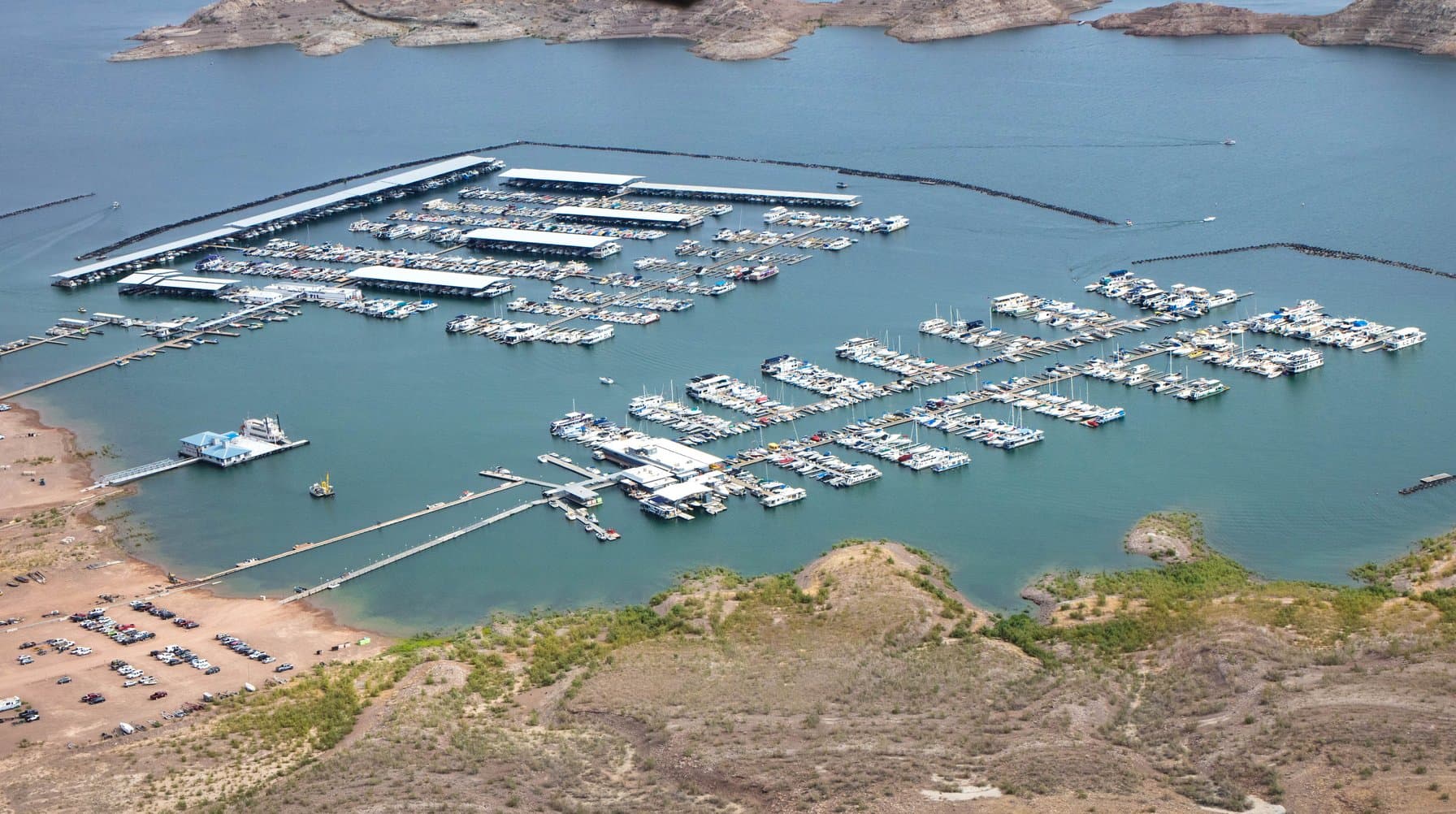
The lake's service end is its north end. Gilbertsville sits below Kentucky Dam with Kentucky Dam Village State Resort Park — marina, lodge and the dam in one frame — and Grand Rivers, at the canal a few miles east, is the village built between the two lakes, with marinas serving both. South of the Eggner's Ferry Bridge, Kenlake State Resort Park at Aurora pairs a state-park marina with a landmark hotel, and Marshall County below it holds the densest run of resorts and rental fleets on the lake.
The Tennessee shore
Paris Landing State Park, at Buchanan, is the Tennessee anchor: 841 acres where the US 79 crossing (the Governor Ned McWherter Bridge) meets the lake, with a full-service marina and lodge. The park marina has hosted dozens of professional bass and crappie tournaments — Paris, inland, is the tournament town. South of there the lake narrows toward its river character: New Johnsonville, the wide Duck River embayment, and the long run down to Pickwick.
Fishing Kentucky Lake: Ledges, Crappie and the License Line
TVA and TWRA list the same core fishery: largemouth and smallmouth bass, black and white crappie, bluegill and redear sunfish, three species of catfish, sauger and white bass. Its national identity is the summer ledge bite — bass schools holding on the old river channel's drops, found with electronics and fished offshore — balanced by spring crappie in the creek arms and the tournament calendar running out of Paris Landing. A big-water fishery with a small-water season, and the two halves barely overlap.
The reciprocity zone
One license covers both states only inside a defined band. Under the Kentucky–Tennessee reciprocal agreement, an angler licensed in either state may fish the other's waters from Eggner's Ferry Bridge (US 68/KY 80) south to the Governor Ned McWherter Bridge (US 79/TN 76), embayments and tributaries included — except Blood River, which is not covered. Inside the zone you follow the regulations of the state that issued your license; fishing from the bank, you follow the state you are standing in. The Kentucky Department of Fish and Wildlife's reciprocal-agreements page is the working text; TWRA's Kentucky Reservoir page carries the Tennessee side. The agreements expired earlier in 2025 and were reinstated effective October 16, 2025 — worth a fresh check before a spring trip, because the lapse proved they can lapse.
Two States, Two Rulebooks: Registration and Boater Education
The fishing reciprocity stops at fishing. Boating law follows the water under your hull, and the two states wrote different rules. On the Kentucky side: operators must be at least 12 to run a motor of 10 horsepower or more, and 12-to-17-year-olds operating on their own must hold a Kentucky Safe Boating Certificate from a NASBLA-approved course; children under 12 must wear a life jacket in the open portion of a boat underway. Kentucky registration runs through the county clerk and expires April 30 each year. The Kentucky Fish and Wildlife boating FAQ has the details.
Cross the invisible line — it follows the old river channel down the lake's middle — and Tennessee's rule applies: residents born after January 1, 1989 must hold TWRA's Boating Safety Education Certificate for a motorized vessel over 8.5 horsepower, and non-residents in that band need NASBLA-approved proof. Brief your crew on which shore you will actually run before anyone takes the helm.
The Best Boats for Kentucky Lake
Bass boats own the headline fishery: the ledge season, the spring bay work and the Paris Landing tournament circuit are all bass-boat water. Pontoons are the second platform — LBL bay days, family cruising and the rental fleets all run on them, for the reasons in our guide to the best pontoon boat brands. Cruisers and houseboats get a version no other inland lake in the region can copy: 184 miles of channel plus the canal hop into Barkley's thousand-plus shoreline miles turns one launch into a two-lake, week-long route. Tow boats and personal watercraft work the wide mid-lake reaches — minding the tows, which cannot leave the channel for anyone. Start with the boats listed for sale and filter by the water you will actually run: ledges, bays or the long river.
Frequently Asked Questions
How big is Kentucky Lake?
160,300 acres and 2,064 miles of shoreline at summer pool, running 184 miles from Kentucky Dam to Pickwick Landing Dam — the largest artificial lake by surface area east of the Mississippi. Tennessee holds 108,217 of its acres; Kentucky, 52,083.
Can I fish both sides of Kentucky Lake on one license?
Only inside the reciprocity zone: from Eggner's Ferry Bridge (US 68/KY 80) south to the Governor Ned McWherter Bridge (US 79/TN 76), embayments included except Blood River. There, either state's license is honored and you follow your license state's rules; from the bank, the shore state's. Outside the zone you need the license of the state whose water you are fishing.
When does Kentucky Lake drop to winter pool?
TVA draws the lake down from summer pool (359 feet) toward winter pool (354 feet) across autumn, holding the lower level through winter for flood storage before bringing it back up in spring. Shallow bays and some ramps lose their water as it falls — check TVA's posted levels first.
Do I need a boater education card to run Kentucky Lake?
It depends which state's water you are on. Kentucky requires its Safe Boating Certificate for operators aged 12–17 running a motor over 10 horsepower on their own. Tennessee requires TWRA's Boating Safety Education Certificate from residents born after January 1, 1989 for motors over 8.5 horsepower, with NASBLA-approved proof accepted for non-residents in that band.
Kentucky Lake Boating Guide: Final Word
Kentucky gets two giant lakes and they are not the same animal: our Lake Cumberland boating guide covers a Corps lake of coves and houseboats, while Kentucky Lake is a TVA river that thinks in ledges, levels and state lines. Learn its five-foot breathing, respect the channel, pick your shore state first — then go big. When you are ready to run it on your own hull, browse the boats for sale at BoatDealsDirect.com and start at the north end.